Using SVG files to represent geographic maps offers other advantages, in addition to the ability to change the scale and position on the map. I can change the visibility of the various layers, or select some elements and highlight them with a different color. I can also save all these changes so that I can get a new file.
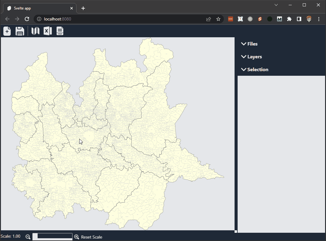
Manage layers in an SVG file
SVG does not natively implement a system for managing layers. But Inkscape yes, it’s free, and it’s my first choice. There are just a couple of things to keep in mind.
Inkscape adds some special attributes to the g element. Use these attributes to identify a layer from a normal group:
inkscape:groupmode="layer": indicates that the group is a layerinkscape:label="Custom Label": it is used to assign a label to the layer in order to identify it visually in an editor
I can extract individual layers from a file using a command similar to this:
Little more specific, I add these lines in the onFileSelected function in the main file of my project:
After obtaining the list of the various levels, I can check which of these are visible and which are not. To do this, I just need to check everyone’s style. I check the value of display in both inline and computed style styles:
This way I can use a condition to indicate whether the layer is visible or not.
By adding an event to the level list I can also change the visibility of each individual level:
Select individual elements
Another useful thing is the ability to select one or more elements. Selection involves some design decisions.
I can keep track of the various selected elements through a list (i.e. an array) or by modifying the elements themselves by adding a specific attribute. I chose to go both ways:
- I use an array to keep track of all the selected elements, so that I can manage them together more easily
- I add the
selectedattribute with values0or1to be able to keep memory of the selection (so that I can restore it when reopening the file).
I use element.getAttribute("selected") to check whether the element is selected or not. If the selected attribute does not exist then I need to create a new one with element.setAttribute("selected", 0). If it exists and has the value 1 then I add it to the selection array with selection.push(element).
To avoid problems later on, I should be sure that the same element is not inserted multiple times in the array. The quickest method is perhaps to convert the array to a Set and then back to an array using selection = [...new Set(selection)].
Putting it all together I get:
You need a method to select the various elements. A simple one is to use the mouse: with one click you select the area, with a second click you deselect it. To do this I need to add an event listener
Save the SVG file
After selecting the elements and setting the visibility of the various levels, it’s time to save the map. I choose to save all the information so that I can eventually resume work from the same point.
After a bit of testing I found some critical issues, especially if I run this app in Electron. To solve these problems I use two repositories:
- blob-polyfill: Blob.js implements the W3C Blob interface in browsers that do not natively support it
- file-saver: the solution to saving files on the client-side, and is perfect for web apps that generates files on the client
I import these two components into my project with
npm i blob-polyfill file-saver
And I add a function to the page:
I have to use replaceAll(" ", "") because sometimes Non Breakable SPaces unsupported by SVG format may appear.
That is all for the moment.
In the next post I will talk about how to change the attributes starting from a json and xls file.


